Map of USA States: Labeled with Cities & Free PDFs
Whether you’re planning a cross-country road trip, helping a kid ace a geography quiz, or just want to know exactly where Nebraska sits relative to Kansas, a good map of USA states makes all the difference. This guide rounds up free printable PDFs, interactive tools, and labeled resources that show all 50 states alongside their capitals and major cities.
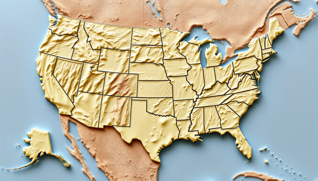
Number of States: 50 · Federal District: 1 (District of Columbia) · Inhabited Territories: 5 · Continental States: 48 · Non-Contiguous States: 2 (Alaska, Hawaii)
Quick snapshot
- The United States comprises exactly 50 states (Seterra GeoGuessr)
- Five territories are inhabited: Puerto Rico, Guam, US Virgin Islands, American Samoa, Northern Mariana Islands (U.S. Geological Survey)
- GIS Geography colorizes all 50 states with major, minor, and capital cities labeled (GIS Geography)
- Map accuracy and scale are rarely compared across different sources (InkPx)
- Most resources focus on static printable PDFs rather than interactive maps (GIS Geography)
- USGS National Atlas continues offering hundreds of free printable reference maps for home, office, or classroom use (U.S. Geological Survey)
- Seterra provides four free printable PDF map variants for geography education (Seterra GeoGuessr)
- Free printable PDFs remain the most accessible option for students and educators needing labeled state maps
- Interactive Google Maps views allow users to zoom to individual states with city-level detail
| Label | Value |
|---|---|
| Total States | 50 |
| States with Capitals Shown | All 50 |
| Major Cities Typically Mapped | Over 100 |
| Printable PDF Variants (Seterra) | 4 |
| Territories Included | 5 |
| USGS Printable Maps Available | Hundreds |
| Capitals and Major Cities PDF Size | 125kb |
USA Map with States and Cities
A labeled USA map with states and cities shows all 50 state boundaries alongside their major urban centers. These maps serve as practical references for education, trip planning, or home and office décor. Sources like GIS Geography colorize each state and layer in major, minor, and capital cities, including Washington, DC as the nation’s capital city. The University of Alabama Maps repository offers basemaps that display state lines, capitals, and major cities in both PDF and JPEG formats.
State Borders and Labels
Clear state borders make it straightforward to identify each state visually. Arizona Geographic Alliance provides a color PDF that labels all 50 US states, including Alaska, with state names clearly visible against distinct fill colors. For custom labeling needs, InkPx map provider allows users to adjust outline colors and text labels across all 50 states.
Teachers and parents can choose maps that match their needs: state names only for memorization exercises, or full city overlays for geography lessons that cover urban distribution.
Major Cities Overlay
City overlays on state maps range from capitals to regional population centers. The GIS Geography map includes the nation’s capital Washington, DC as a labeled point alongside dozens of other cities. According to the GIS Geography mapping site resource, this type of map “colorizes all 50 states in the United States of America” while positioning cities for geographic context.
Large Map of USA with States and Cities
High-resolution USA maps display detailed state outlines and legible city labels that work well for large-format printing or detailed digital viewing. Resources vary in scope: some focus narrowly on state boundaries, while others layer in highways, waterways, and regional geographic features alongside city markers.
High-Resolution Details
For classroom posters or office maps, resolution matters. Alabama Maps at the University of Alabama offers a “Capitals and Major Cities of the USA” PDF at just 125kb—compact enough to download quickly yet detailed enough for basic reference. FreeUSandWorldMaps royalty-free clip art provider provides royalty-free clip art maps that include highways, state names, capitals, and waterways in formats compatible with Adobe Illustrator and PowerPoint.
Regional Breakdown
Most maps include all 50 states, though Alaska and Hawaii often appear as insets due to their non-contiguous locations. The Arizona Geographic Alliance explicitly includes Alaska on their color PDF, ensuring both non-contiguous states receive full labeling treatment.
“Our maps are high quality, accurate, and easy to print. Detailed state outlines make identifying each state a breeze while major cities are clearly labeled.”
USA Map with States and Cities PDF
Free PDF downloads make it simple to print labeled USA state maps for personal, educational, or classroom use. Several sources offer these files at no cost, though each varies in what they label and how they present the data.
Download Sources
WaterproofPaper.com printable resource provides a free printable PDF map of the US with states and state capitals labeled. Seterra GeoGuessr educational platform offers four free printable PDF maps: blank US states, labeled US states, US states map quiz, and an answer key. Your Child Learns state-specific printable resource provides printable labeled US state maps for color or black-and-white printers, with state-specific selections available in multiple sizes.
Printable Formats
Print quality depends on the source. InkPx offers maps in PNG, JPEG, and PDF formats, allowing users to select the resolution that fits their printer setup. Their maps are described as suitable for education, road trip planning, or home decoration. Seterra’s blank map features 50 numbered spaces where students label state names, making it ideal for geography quizzes.
Free PDF maps cover most needs without registration, giving educators and students immediate access to quality cartographic resources.
Google Map of USA States
Google Maps provides an interactive alternative to static printables, letting users zoom to individual states, search for cities, and explore geographic relationships in real time. Unlike PDFs, Google Maps requires no download and updates automatically as users navigate.
Interactive Features
Google Maps allows users to pan, zoom, and search across the entire United States. While the default view does not automatically label all 50 state boundaries, users can bookmark specific states or create custom maps that overlay additional information. GIS Geography mapping site notes that few sources offer truly interactive maps—most resources focus on static printable PDFs rather than clickable or searchable alternatives.
Zoom to States
Zooming into a specific state on Google Maps reveals city-level detail, highways, and local geography. This approach works well for trip planning but lacks the comprehensive overview that a labeled printable map provides. The trade-off between detail and context is practical: for quick reference or study, a PDF with all states labeled works faster than navigating zoom levels on an interactive tool.
“The National Atlas offers hundreds of page-size, printable maps that can be downloaded at home, at the office, or in the classroom at no cost.”
US States List
A complete US states list correlates with map positions and helps learners memorize state locations by name. The list of all 50 states, when paired with a map, creates a powerful study tool for geography students and trivia enthusiasts alike.
Alphabetical Order
Listing states alphabetically provides a reference tool alongside visual map study. The 50 states, from Alabama to Wyoming, represent a standardized set that has remained fixed in number since Hawaii joined in 1959.
With Capitals
Pairing state names with their capitals creates a secondary memorization layer. Maps like the University of Alabama’s basemaps specifically label “Capitals and Major Cities of the USA,” showing the nation’s capital Washington, DC alongside all 50 state capitals.
Related reading: Arizona · Las Vegas
Travelers and students alike appreciate pairing this resource with the printable interactive US states guide for blank templates and dynamic quizzes on all 50 states.
Frequently Asked Questions
What is the standard number of states in the USA?
The United States comprises exactly 50 states, confirmed by multiple sources including Seterra GeoGuessr.
Does the USA have 52 states?
No, the USA has 50 states. Some confusion arises from counting Washington, DC as a “state” or including territories, but the official count is 50 states.
Where are Alaska and Hawaii on a USA map?
Alaska and Hawaii are non-contiguous states. Alaska appears northwest of Washington state as an inset, while Hawaii sits in the Pacific Ocean southwest of California. Both are labeled on most complete state maps, including the Arizona Geographic Alliance PDF.
What are US territories shown on maps?
The five inhabited US territories are Puerto Rico, Guam, US Virgin Islands, American Samoa, and Northern Mariana Islands. These are sometimes included on reference maps alongside the 50 states, as noted by the U.S. Geological Survey.
Can I use Google Maps to explore individual US states in detail?
Open GIS Geography or standard Google Maps, pan to the United States, and use the zoom controls or scroll wheel to enlarge a specific region. Search for a state name in the map’s search bar for direct navigation.
Are there official USA state map PDFs?
Yes. The U.S. Geological Survey offers hundreds of page-size printable maps as official government resources. The University of Alabama also provides academic basemaps with states and capitals labeled.
What cities are on basic USA state maps?
Basic maps typically show capital cities and major metropolitan areas. GIS Geography includes major, minor, and capital cities. Minor cities beyond major urban centers vary by source, with most resources focusing on population centers rather than exhaustive city listings.
More related posts
 Marvel Rivals Patch Notes – Latest Changes and History
 Arm and Hammer Cat Litter – Reviews Performance Best Types
 6000 CAD to USD: Convert Canadian Dollars to US Dollars
 Diane Ladd Movies and TV Shows: Full Credits List
 Tim Cook: Biography, Career, LGBTQ Identity & Facts
 108 kg to lbs: Pounds, Stones, BMI and Health Guide
 Robert De Niro: Family, Facts & Controversies
 How to Measure Bra Size at Home: Guide & Charts